

The Jumble Sale Find
The map cost fifty pence.
Iris Okwu had not gone to the church jumble sale looking for a map. She had gone because her mum volunteered at it every year and expected Iris to help for at least the first hour before being released into the rest of her Saturday, and also because the book table occasionally had things worth finding if you got there early enough. She was twelve, methodical about reading, and had learned from experience that arriving at jumble sales after ten o'clock meant the best things were gone.
She had found two books worth keeping and was on her way back to help her mum fold donated clothes when she stopped at the table of miscellaneous paper items: old greetings cards, a bundle of sheet music, several framed pictures of uncertain quality, and at the back, rolled and held with a rubber band, a map.
She picked it up. The rubber band disintegrated when she touched it, which told her something about its age. She unrolled the map carefully.
It was large, roughly A2 size, printed on thick paper that had gone slightly yellow at the edges. It showed the town of Whitmore and its surrounding area, in the detailed style of an Ordnance Survey map but with some differences in presentation that suggested it was either a copy or a variant. Roads, footpaths, field boundaries, buildings, contour lines. Place names in the clear lettering of professional cartography.
She looked at it for a moment, enjoying the particular pleasure of a detailed map, the way it reduced the world to something navigable and clear.
Then something caught her eye.
The river was wrong.
The River Wyne ran through Whitmore from north to south, entering the town near the old mill and joining the larger River Ashton about two miles to the south. Iris had lived in Whitmore her whole life and she knew the Wyne the way you knew geographical features of your home town, not with expert knowledge but with the solid familiarity of a thing always present.
On this map, the river ran differently. It entered the town from the northwest rather than the north, curved through the centre in a wider arc, and exited to the southeast. Not the same route at all. Not a minor cartographic variation but a substantially different geography.
She looked at the map's title, printed in the top right corner: Whitmore and Environs. Surveyed and Drawn 1879.
She looked at the river on the map again.
She bought it for fifty pence, rolled it carefully under her arm, and went to find her mum.
Her mum looked at the map with polite interest and said it was probably just an old inaccurate survey. Her dad, who was an engineer and thought about these things differently, looked at it for longer and said that rivers could and did change course over time, through natural processes or human intervention, and that an 1879 map showing a different course was not necessarily wrong, just historical.
"But I can see the river from my bedroom window," Iris said. "And it's in the same place it's always been."
"Over your lifetime," her dad said. "Which is twelve years. Rivers move over longer timescales."
"Could the river have changed course between 1879 and now?"
"Possibly," her dad said. "Or the 1879 map could be inaccurate. Or there could be another explanation entirely." He gave her the map back. "Why does it matter to you?"
Iris thought about this. It was a fair question. She was not sure she could articulate why she found it significant. There was something about the specific nature of the difference, the river's course was not slightly different but substantially different, taking a completely different path through the town, that made the inaccuracy explanation feel insufficient. A surveyor making errors might get a river slightly wrong. Getting it completely wrong seemed harder to do accidentally.
"I think it's interesting," she said, which was not a complete answer but was the truest one she had.
Her dad smiled. "That's usually enough reason," he said.
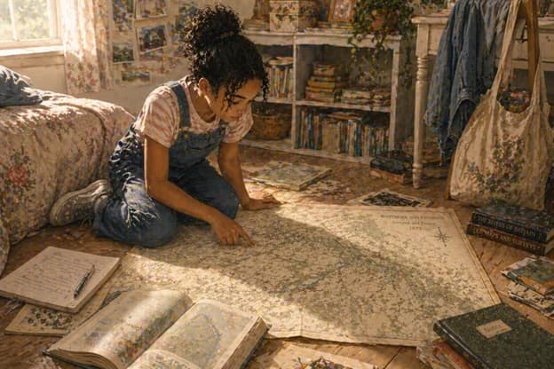
She took the map upstairs and unrolled it on her bedroom floor and spent the evening going over it with her school atlas open beside her for comparison. The river was the only major discrepancy. Everything else, the roads, the field patterns, the building layouts, corresponded closely enough to the current geography to confirm this was definitely Whitmore and not somewhere else.
Just with a different river.
She wrote in her notebook: Map, 1879. River Wyne shown on different course. All other features consistent with current Whitmore geography. Either the map is wrong about the river, or the river has changed, or something else I haven't thought of yet.
She underlined the last option.