

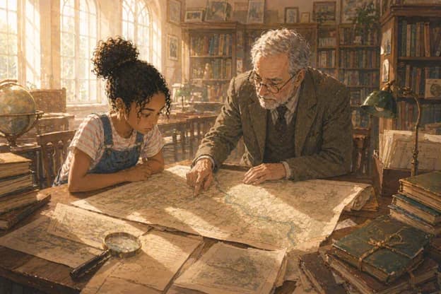
The Local History Room
The town library's local history room was on the first floor, staffed on Saturdays by a volunteer named Mr Fenwick who had the encyclopaedic knowledge of local geography that retired surveyors tended to accumulate. Iris had spoken to him twice before on unrelated research and found him both helpful and precise.
She brought the map. He looked at it for a long time, first at a distance and then close up, with reading glasses produced from his breast pocket.
"Where did you get this?" he asked.
"Church jumble sale," Iris said. "Yesterday."
He made a sound that might have been approval or disapproval, difficult to determine. "This is a Hartley survey," he said. "Robert Hartley, local cartographer, made several surveys of Whitmore and the surrounding area in the 1870s and 80s. His work is generally reliable." He paused.
"Which makes this interesting."
"Because the river is wrong," Iris said.
"Because the river is shown differently," he corrected, with the precision of someone who considered those two things distinct. "Wrong implies error. Different might imply something else." He put the map on the reading table and smoothed it flat. "This course," he traced the river's path with one finger, not touching the surface, "follows the lower ground through the valley. Which is actually more consistent with the natural watercourse than the current route."
Iris looked at him. "You mean the current route is the artificial one?"
"I mean it's possible," he said. "Rivers are diverted for various reasons. Mill operations, flood management, agricultural drainage. A diversion at some point between 1879 and the present would explain why Hartley's 1879 survey shows a different course." He sat back. "What would be useful is finding the historical record of any such diversion. If it was an engineering project of any scale, there would be documentation."
"Where would I find that?"
"County archive," he said. "Canal and river authority records. And there's a collection of local engineering records from the late Victorian and Edwardian period in the archive that would be worth looking at." He paused. "There's also a man named Clifford Marsh who has spent thirty years studying Whitmore's water management history. He'd be worth speaking to. I can give you his contact details if you like."
"Yes please," Iris said.
She spent the next hour in the local history room going through Mr Fenwick's suggested sources, finding a number of references to the River Wyne but nothing immediately addressing a course change. She photographed several relevant pages.
On her way out she passed the new books display and stopped.
One of the books was a recently published local history of Whitmore. She picked it up and checked the index for River Wyne. There were three page references. She turned to the first.
The entry mentioned the river briefly in the context of the town's mill history. A footnote read: The current course of the River Wyne through the town centre dates to a channelling project completed in approximately 1895, replacing an earlier natural course that had proved problematic for the development of the Harker Street area.
1895. Between Hartley's survey in 1879 and the present day.
Iris wrote this down and felt the particular satisfaction of a piece fitting into place.
The river had been deliberately moved. The 1879 map was not wrong. It was right, for its time.
And the question now was why, exactly, it had been moved, and whether that was the whole story.
She emailed Clifford Marsh that evening. He replied the following morning with the enthusiasm of someone who did not get many enquiries about water management history and intended to make the most of this one.
He knew about the 1895 channelling project. He had researched it extensively. He said the documentation was in the county archive and he would be happy to meet her there on Saturday and go through it with her.
She went on Saturday with her notebook and her map and found Clifford Marsh to be exactly the kind of person his email had suggested: somewhere between sixty and seventy, carrying an amount of folders that implied significant preparation, and visibly pleased to be here.
The documentation was substantial. The channelling project had been commissioned by the Whitmore Town Improvement Committee in 1893 and completed in 1895. Its stated purpose was drainage improvement and the facilitation of development in the lower town area, specifically the Harker Street district, which had suffered from periodic flooding.
This was all consistent with the footnote she had found. But as she and Clifford worked through the documents, she found something that the footnote had not mentioned.
The Harker Street development. She looked at the plans. The area where the river had previously run, the old course shown on Hartley's 1879 map, had been developed after the channelling project. New streets, new buildings, the infrastructure of the lower town as it existed today.
Including, she noticed, looking at the development plans and then at a modern street map on her phone, the site of what was currently the Whitmore Royal Hotel.
She looked at this for a while.
"The hotel," she said.
Clifford looked at where she was pointing. "Built 1897," he said. "On the site of the old river course, made available by the channelling project."
"Who commissioned the channelling project?" Iris asked.
Clifford pulled another document. "The Town Improvement Committee," he said. "Chaired at the time by Alderman Thomas Harker." He paused. "After whom Harker Street is named."
"And the hotel was built on land that became available because of a project chaired by a man whose name is on the street," Iris said.
Clifford looked at her with an expression of someone who had had this thought himself and was pleased to see someone else arrive at it independently.
"It does raise questions," he said.
"Who benefited from the channelling project?" Iris asked.
"Officially, the town," Clifford said. "In terms of flood management. Which was a genuine benefit, to be fair." He paused. "But the development of the Harker Street area, made possible by the project, was primarily beneficial to the individuals who owned the land and built on it."
"Including Alderman Harker," Iris said.
"He owned a significant portion of that land, yes," Clifford said.
Iris wrote in her notebook: 1895 channelling project moved the River Wyne. Project chaired by Thomas Harker. Land along old course developed, including hotel site. Harker owned the land.
She looked at what she had written.
She thought: this might be a very old story about someone using public authority for private benefit. Or it might be a coincidence. She needed more.